May recorded an average minimum of 11.9C.
This was only 0.8C warmer than the average June minimum for Rockhampton.
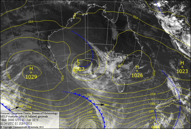
Straight away one thinks this will follow with more colder wintery nights? All due to a stronger than usual High being in a winter position over Australia.
Making the normally winter fogs form over non traditional areas for May.
The Fons said he saw a fog on the Gracemere road near the 70k sign.
Yet the airport had no reports of fog – very unusual. Being the third most fog prone Airport in Australia. In the south, frosts were abundant. Oakey recorded minus 5.7C – Ouch!
Brisbane Airport its coldest average minimum for the month. Plus many places in NSW recording all time cold minimums. Sorry I had no time to get the data for Queensland. While the average May minimum for Rolleston 6C (4.6C below average) Thangool was 6.0C (4C below average), Gladstone AP 13C (3C below average, Yeppoon 14C (2C below average). Anything more than 2C below is significant in Meteorological Statistics. Yes! A very cold time. On the rainfall side Rocky recorded technically 20.4mm for the month. Now there was a malfunction in the gauge which under read the mid month heavy fall.
If we add maybe a 30mm factor ( getting heady here!) then January to May total should read 355mm ( roughly). While the long term average is 465mm. This equates to 73 per cent of our normal rainfall. Around the state hardly anything in southern Queensland with the cold dry air for the week. Still some interesting totals (mm) in the Gumboot Country for the week – Victoria Mill, Hawkins Creek 32. In a so called La Nina year. Long term forecasts are saying winter will be warmer during the day and colder during the night. Even minus 18.5 for the SOI late May – on the way to minus 20 – has not been recorded in over 155 years of records. What does this mean? Story next week!!
CANADA – The wildfires continue with over two million hectares burned. Stepped up “water bombing” plus reinforcements from the USA, South Africa and Australia are making some improvement. Yet ” Mother Nature” keeps the drier Arctic air funneling into North America. Authorities are hoping a low developing Monday off the coast of eastern Canada, may cause showers and storms to quell the fires in the east. And High Based Storms ( can cause dry lightning) in Central Canada have enough rain to help belay the fires in Alberta.
USA – Hurricane Season is on the way. Storms are developing over 27C plus waters in the Gulf of Mexico west of Florida. If convective development continues into Sunday then it should get a circulation and Arlene may develop and head south. If the upper jetstream punches in then it could die.
JAPAN – Typhoon ‘Mawar’ that impacted Guam earlier in the week with winds gusting 252kph. Is now impacting coastal Japan. Forecast of 350mm for Honshu Islands on Saturday. Over 37,000 people were advised to evacuate in Toyohashi.
FORECAST
The last four days of May had cold dry average minimums of 7C and brilliant dry sunny 24-25C afternoons. Our first day of WINTER reached a min of 10.5C in Rocky – right on the average!
As the large high over the NSW coast moves east moist south east air off the Coral Sea is now covering most of eastern CQ. Patchy cloud developed across CQ Friday heralding the thicker cloud to come over the weekend. That has been lurking east of the Keppels during the past week. It reaches the River City Saturday with coastal drizzle early in the morning. Then patchy drizzle on the Berserkers Saturday afternoon. Maybe a few spits at the Ridgelands Show. Boaties! Might be a little damp early and the 15 knots winds Saturday making it uncomfortable.
Then SOTW! Stay off the Water Sunday as the winds ramp up to gust over 20 knots( 37kph). Then it should stay till mid-week. This means 15C minimum nights for the Fitzroy and cloudy 25C days Sunday to Tuesday. With early drizzle less than a millimetre (more on the Berserkers and Mt. Morgan) reaching into the Central Highlands. As the ridge weakens the winds ease around Wednesday still early coastal drizzle north of Stockyard Point to Shoalwater. Sunny days follow with minimums cooler allowing yet another FF! Chance of an early Foggy Friday. Boaties! Friday and Saturday are the go!?


